How Digital Mapping and 3D Visualization Are Changing How We See the World
Have you ever looked at a map and wished it could show more than just streets and names? What if you could see mountains, buildings, and rivers just like in real life? This is what digital mapping with 3D visualization does. It turns ordinary maps into realistic, three-dimensional maps that you can move around and view from different angles.
This technology is helping people in many areas, including city planning, education, science, and transportation. In this article, we will explain what digital mapping and 3D visualization are, how they work, why they are useful, and the tools people use to make them.
What Are Digital Mapping and 3D Visualization?
Digital mapping is making maps using computers instead of paper. These maps can show streets, rivers, buildings, and other details of the real world.
3D visualization adds depth to these maps. Instead of a flat picture, you can see height, shape, and distance. For example, you can see how tall a building is or how deep a valley goes.
When combined, these technologies create interactive 3D maps. You can zoom in, rotate, and move around the map like you are actually there.
How 3D Mapping Works
Creating a 3D map involves three main steps: collecting data, processing it, and turning it into a 3D model.
Step 1: Collecting Data
Before making a map, we need information about the real world. This data can come from:
- LiDAR: A laser scanner that measures distances and shapes.
- Drones: Flying cameras that take pictures from above.
- Satellites: Cameras in space that capture large areas.
- Ground surveys: Measurements taken on the land by people.
This data forms a group of points called a point cloud, which shows the shapes of objects like buildings, trees, or mountains.
Step 2: Processing Data
After collecting the data, it needs to be cleaned and organized. This includes:
- Combining images to make a complete map.
- Fixing errors to make sure the map is accurate.
- Identifying objects like roads, rivers, and buildings.
Sometimes, artificial intelligence helps speed up this process and can even update maps in real time.
Step 3: Creating the 3D Map
Finally, the data is turned into a 3D map. To make it look realistic, software uses methods like:
- Level of detail: Shows more detail when you zoom in and less when zoomed out.
- Texture smoothing: Makes surfaces look smooth.
- Surface depth effects: Makes surfaces look three-dimensional without using too much data.
The result is a map you can interact with and view from multiple angles.
Why 3D Digital Mapping Is Useful
Digital mapping with 3D visualization is helpful in many areas. Here are some examples:
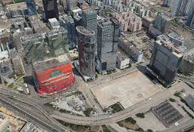
1. City Planning and Construction
Planners and architects use 3D maps to design buildings, roads, and bridges. They can also simulate floods or accidents to see how the city would be affected. This helps save time and money.
2. Mining and Underground Work
3D maps show tunnels, rocks, and minerals before digging. This makes work safer and more efficient.
3. Environmental Studies
Scientists can use 3D maps to study forests, rivers, mountains, and wildlife habitats. This helps plan conservation projects and track changes in nature.
4. Transportation and Self-Driving Cars
Self-driving cars use 3D maps to see roads, signs, and obstacles. This helps them drive safely and avoid accidents.
5. Learning and Education
Schools and universities use digital 3D maps to teach geography, geology, and city planning. Students can examine real locations without leaving the classroom.
Tools and Platforms for 3D Mapping
Several tools make digital mapping and 3D visualization possible. Some popular options include:
- ArcGIS: Helps professionals create 3D maps and analyze data for city planning and research.
- Google Maps Platform: Allows developers to add 3D maps to apps and websites.
- Cesium: Creates interactive 3D maps for education, research, and simulations.
- Other tools: QGIS, SketchUp, Blender, and Autodesk are also used for 3D modeling and visualization.

Benefits of 3D Mapping
- Easy to Understand: Seeing things in 3D helps people understand shapes, sizes, and distances better.
- Better Planning: Cities, buildings, and tunnels can be designed more safely.
- Accurate Data: Scientists and engineers can study maps with higher precision.
- Interactive Learning: Students can learn by virtually interacting with real places.
- Quick Decisions: Governments and businesses can act faster during emergencies.
The Future of 3D Digital Maps
The future of 3D mapping is promising. With artificial intelligence, drones, satellites, and faster computers, maps will become faster to create and more detailed.
Virtual reality and augmented reality will make it possible to walk through a city that hasn’t been built yet or see natural changes like floods or erosion. 3D mapping will continue to help people learn, plan, and work more efficiently.
Conclusion
Digital mapping with 3D visualization is changing how people see and understand the world. From city planning and mining to environmental studies and self-driving cars, this technology helps people make smarter decisions.